

South Salem Alternate Bike Route Avoids Steep Grades and is a Step Toward Salem’s Own Bike Boulevard System
The official cycling route for South Salem provides cyclers with routes around the South Salem area, but does not provide alternatives to high traffic areas and the many hillside ups and downs the route includes.
If you want to avoid steep climbs, or even just avoid streets with high traffic volume, this is the route for you.
Our first leg begins at Bush Park, at the corner of Mission St SE and Church St. SE. in early spring. Leaves have not yet furled, but hold promise.

Church is bisected at Mission by the entrance to Bush Pasture Park.

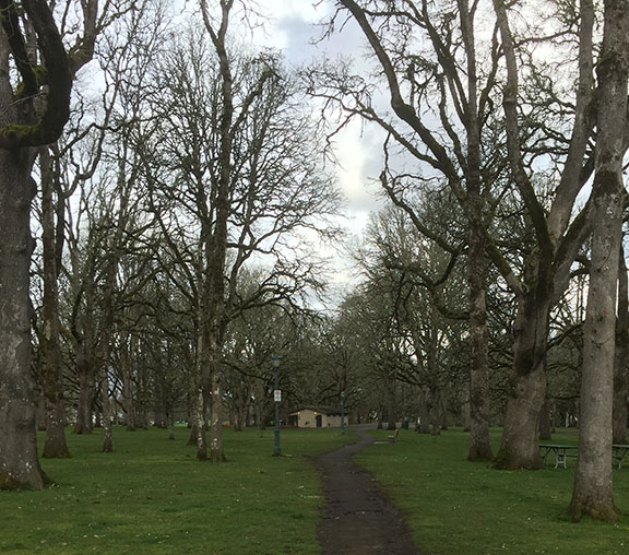
Facing north at the south end of Bush Park
Several lovely pathways will take you through Bush Park.
The most direct passes directly through the middle of the park and brings you out at Leffelle St. SE and Church St. SE.

Church St. SE at the South end of Bush Park,looking south
Church St. SE is a gentle climb until reaching Hoyt St.
Turning left at Hoyt, go east to Winter St SE and stay on Winter for two blocks, until you reach McGilcrest St SE.
Take McGilcrest one block , then turn south on Summer St. SE.

The giant Sequoia on McGilcrest
Stop to notice the enormous sequoia tree on the north side of McGilcrest St. SE.
If it happens to be raining, this is a great place to regroup.
Turn south on Summer St. SE. Go five blocks until it intersects with Fairview Ave. SE.
Go east one block to the intersection of Fairview Ave. SE and continue on Summer St. SE.

Clark Creek crosses under Summer St.
Heading south on Summer St. SE, you will cross Clark Creek.
Turning west on Vista at Summer brings you to Clark Creek Neighborhood Park and the end of leg one.
You will have traveled 1.8 miles from Mission and Church.

Clark Creek passes under Vista St SE at the Entrance to Clark Creek Park
Cycling data for this guide was developed and mapped by The man in the Yellow Hat. 
